Hiking is a wonderful way to stay fit. Not only do you get some fresh air, sunshine, and a beautiful view, but you get in a workout as well. Reservoir Canyon Trail in San Luis Obispo is a fun, but challenging trail that starts just outside of the city. The trail winds its way up the backside of the mountains that face SLO. When you get to the top, you have a gorgeous view of the city, and on a clear day, the ocean.
Distance: 5.35 mi out and back
Elevation: 1350 feet
Notes:
- Add another 1.3 miles if you walk to the red fire tower
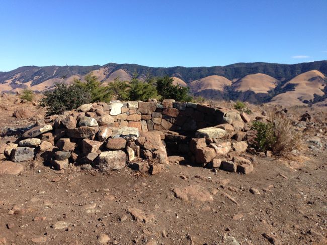
- Once the trail ends, you can take a sharp left to a seating area built out of rocks
- Bring water and sun protection
Directions:
- Take the 101 N from San Luis Obispo
- Once you pass the last exit for SLO (Monterey), take the second right off the freeway. There will be a turn lane.
- Follow the gravel road until you reach a small parking lot. The trail is just behind a gate and cattle guard.
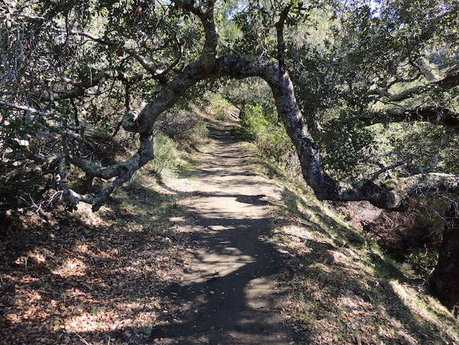
The first mile of the trail is flat. It’s under the shade of oak trees and crosses a creek several times. Most of the creek crossings aren’t an issue because of the drought and footbridges, but there’s one place where jumping the creek might be necessary.
After about a mile, the trail begins to climb upwards. You’ll enter a sculpture park, much like the architecture graveyard near Cal Poly. There’s also a rope swing on a very large Eucalyptus tree. This is a great place to stop for water, especially since the rest of the trail is a steeper climb without much shade.
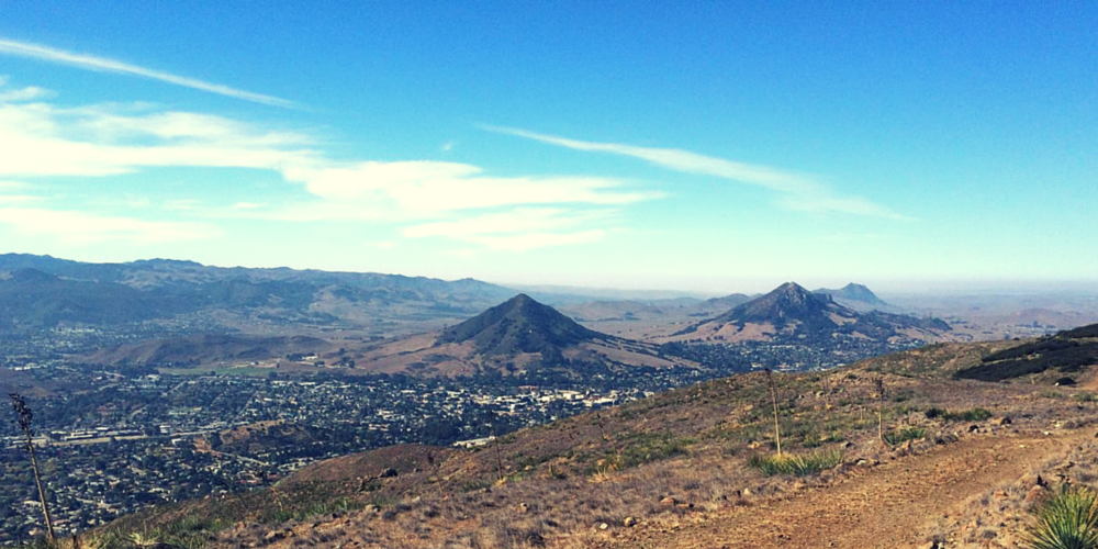
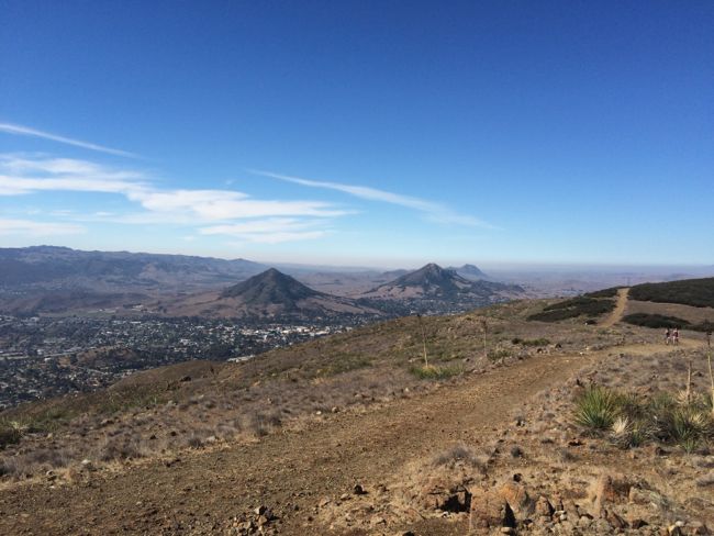
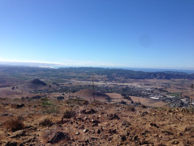
After the scrap metal sculptures, the rest of Reservoir Canyon Trail is quite a hike. Not incredibly difficult, but the grade of the trail is unrelenting. Any time you need a rest, you’ll have views of Cuesta Grade and the Santa Lucia Mountains behind you, so take advantage of that. The view at the top is worth the work.
Once you reach the top of the mountain (which will seem like forever) the trail ends in a T. If you take the path to the right, you’ll come to a red fire tower that was used to spot forest fires. If you take a path about 45 degrees to your left, you’ll come to a seating area constructed out of rocks.
Our Hike
We had a great time on our hike and were completely wiped out afterwards.
Geoff and I went with another couple and our dog, Dixie. Dixie sets a great pace, which is what led to our inability to do ANYTHING afterwards but sit on the couch and recover. We hiked almost 6.67 miles in 3 hours and 10 minutes. While it wasn’t as strenuous as something like Rocky Mountain National Park, it was definitely a workout with a pretty decent view.
The hike itself was gorgeous and a little warm. There wasn’t much of a breeze, so we really appreciated the shade from the trees in the beginning. The creek was just a trickle, but it was good to see that it wasn’t completely dried up.
After the sculpture park, it was a very exposed and sunny hike that seems like it’ll never end. We certainly didn’t take our time getting up to the top, but we did stop a few times for water and rest. Most of the elevation gain is in 1 mile!
The views at the top were just gorgeous. It was a hot walk up to the top, but it was so worth it. Beautiful blue skies and the steep Cuesta Grade behind us with Madonna and Bishops Peak in front. You can see the city, Morro Bay, and out towards Edna Valley, the SLO wine country.
Once we reached the top, we investigated the rock seating area and took a break. After that, we walked another 1.3 miles to the fire tower and back.